Part 1: Mlilwane National Park – 1 November 2024
So, to answer the first question on your mind: where and what is eSwatini?! I’ve found about 10% of people I speak to know the answer. If I say that it’s Swaziland, this reaches about 50%. So, for the rest of you, it’s a landlocked enclave on the east of South Africa, which also borders Mozambique.
It used to be called Swaziland until 2018, when its King (it’s an absolute monarchy, the last in Africa) decided to get rid of the colonial name: eSwatini means “land of the Swazis”. As a side note, the King has 15 wives, which feels a little greedy until you know his Dad had … 125.
It’s pretty small – about 150km by 200km, and is very much off the usual tourist map (seriously hard to find much tourist info online). It’s also dirt poor (153rd/188 in the world) and has one of the highest levels of AIDS in the world (around 25%).
As to why on earth I was there: I had work in Jo’burg the next week (which is right nearby) and, while eSwatini on paper may not sound super attractive, I’ve found in my experience that it’s always good to make your own opinion.
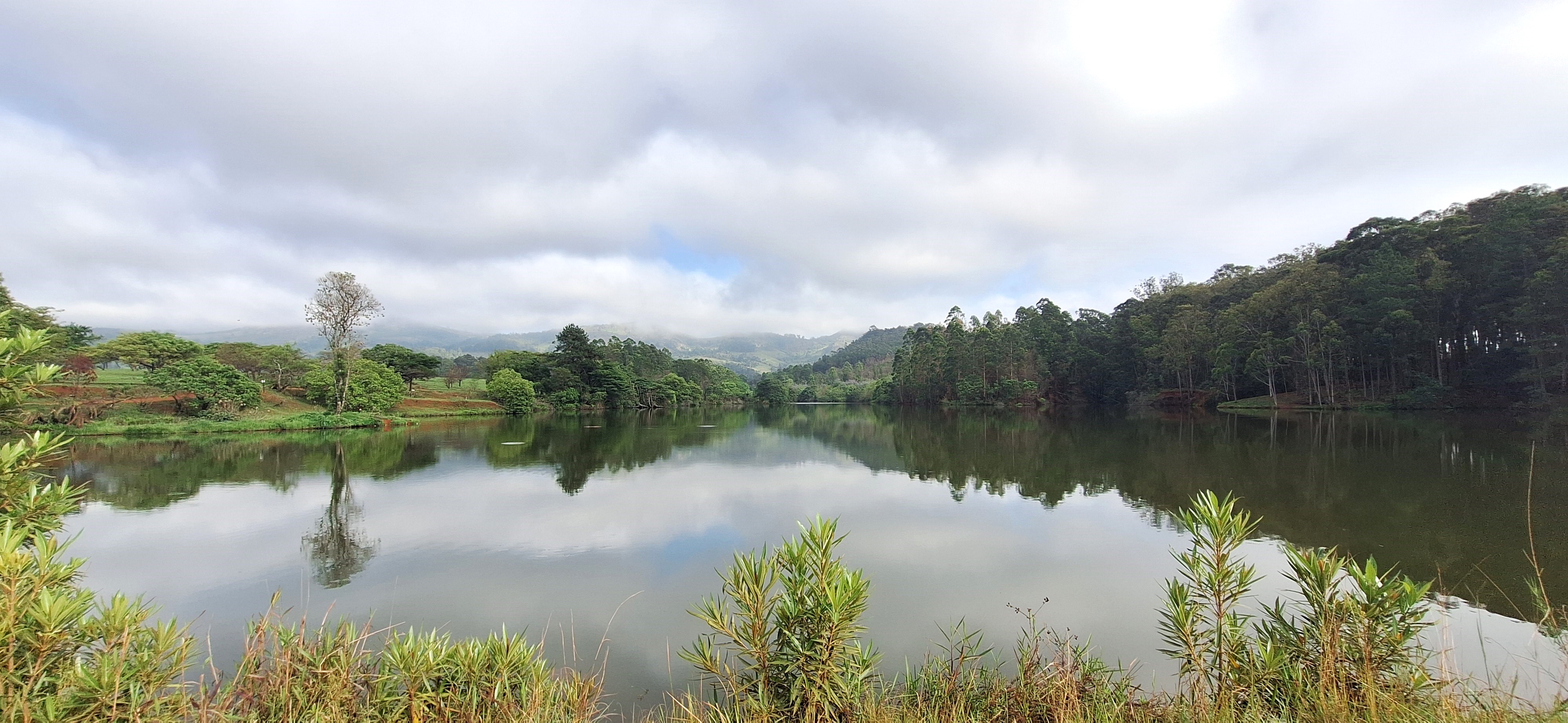
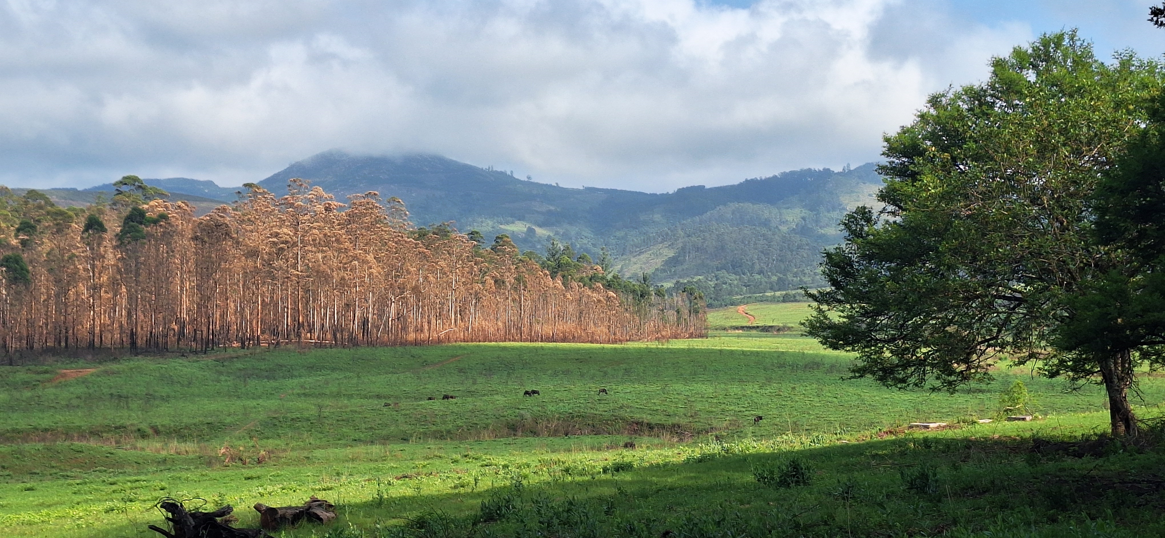
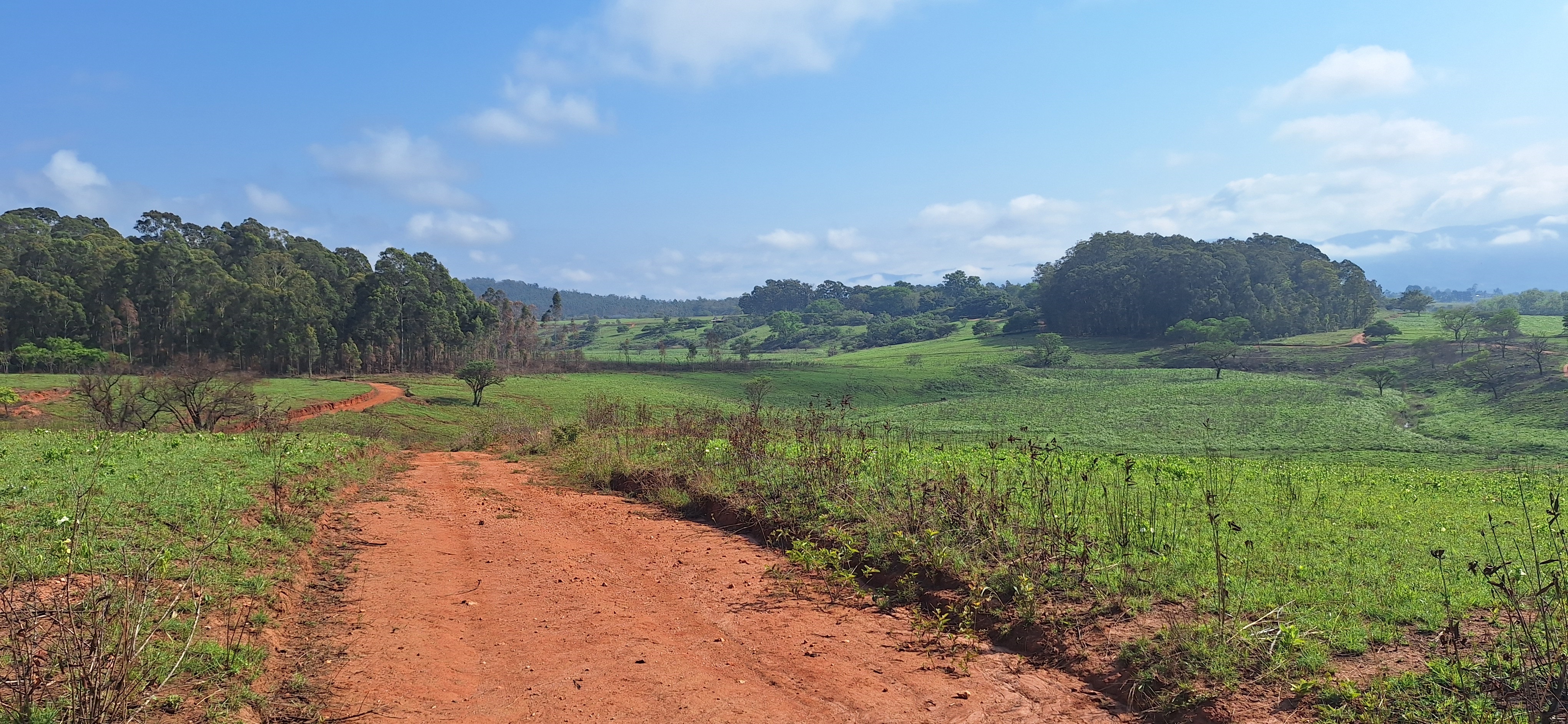
And, in this instance, it was a lovely place to visit! Extremely green, with some national parks and a reasonable number of cultures for a few days’ worth of visit. It’s also, compared to many parts of South Africa, very safe to visit.
That is, unless, of course, you decided to go running in a national park with wild animals but without a guide. Which is not something I would do. Obviously.
Oops.
I’ve been lucky to go to a number of national parks in Africa and have seen every type of major animal there is (I think), apart from the cheetah.
However, understandably, there tend to only be two ways to travel: 1) in a 4×4 with a guide or 2) in some instances, in your own car.
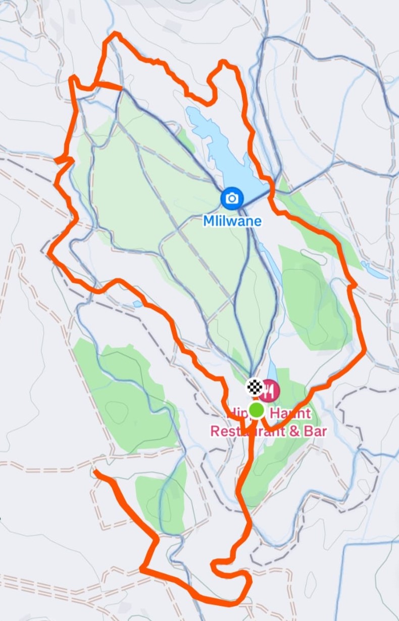
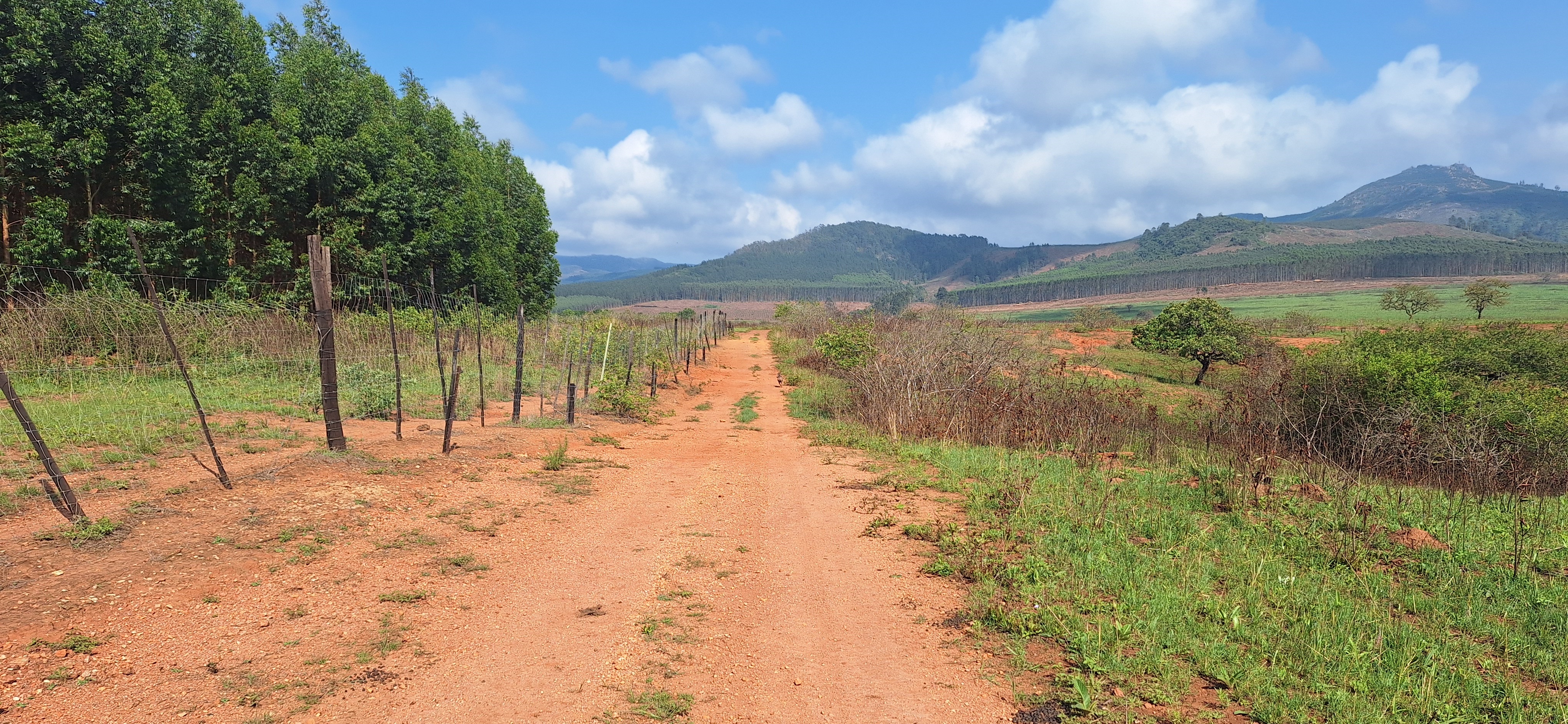
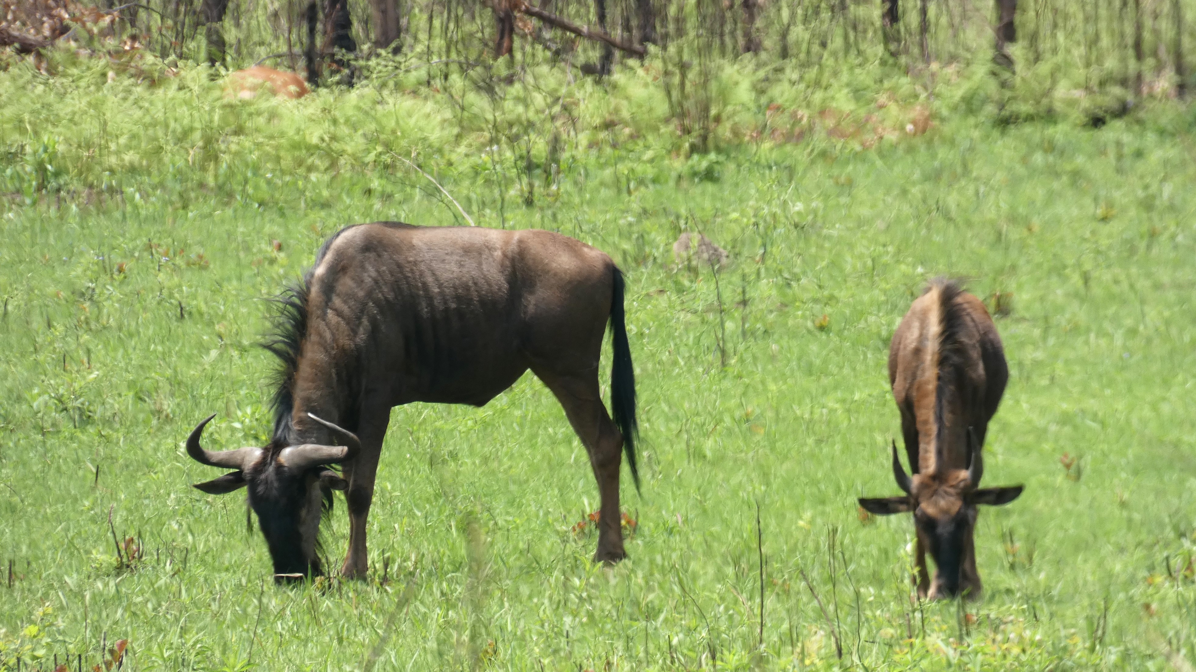
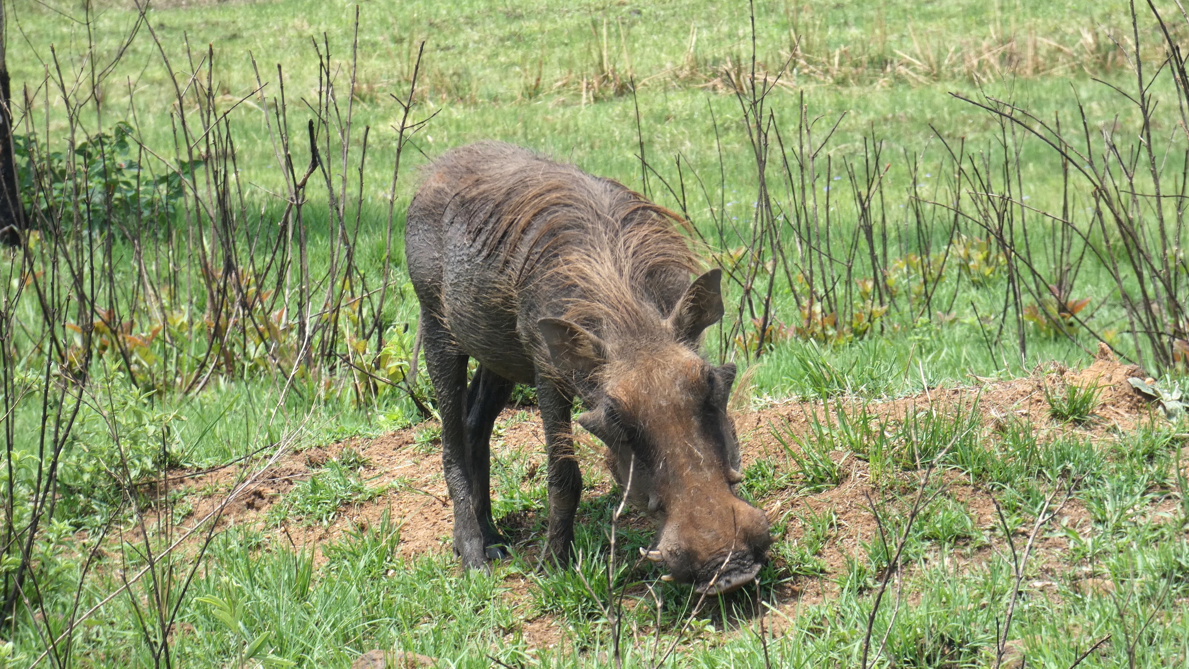
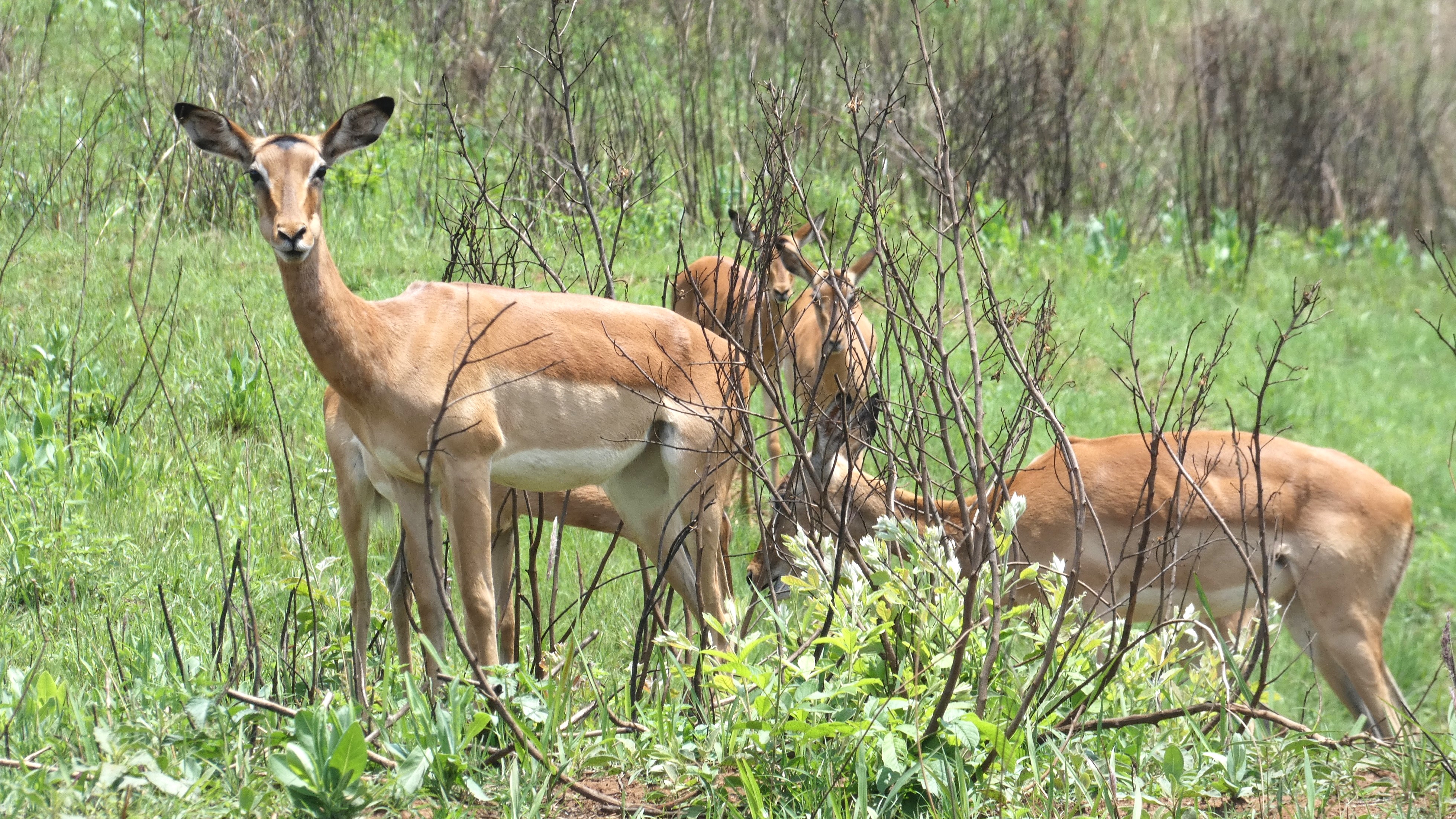
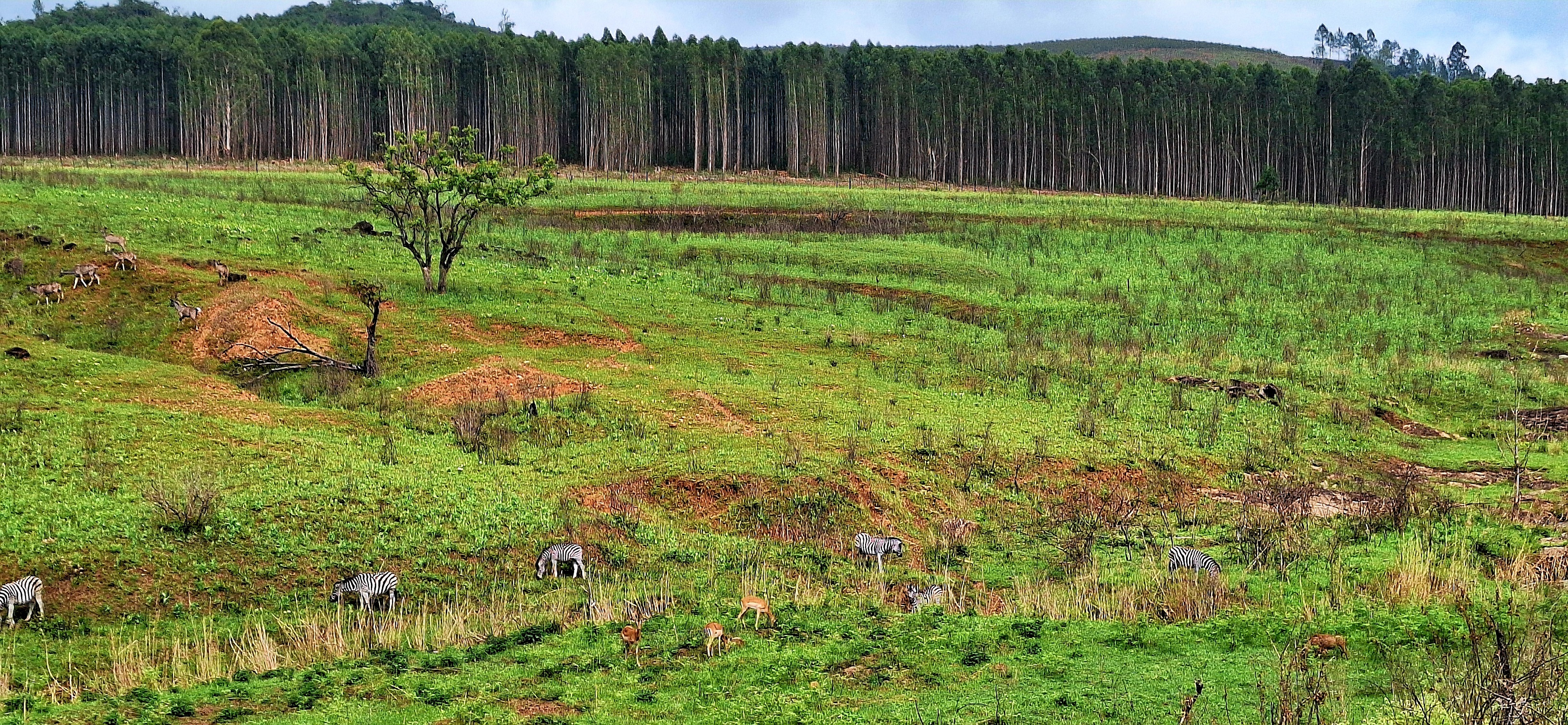
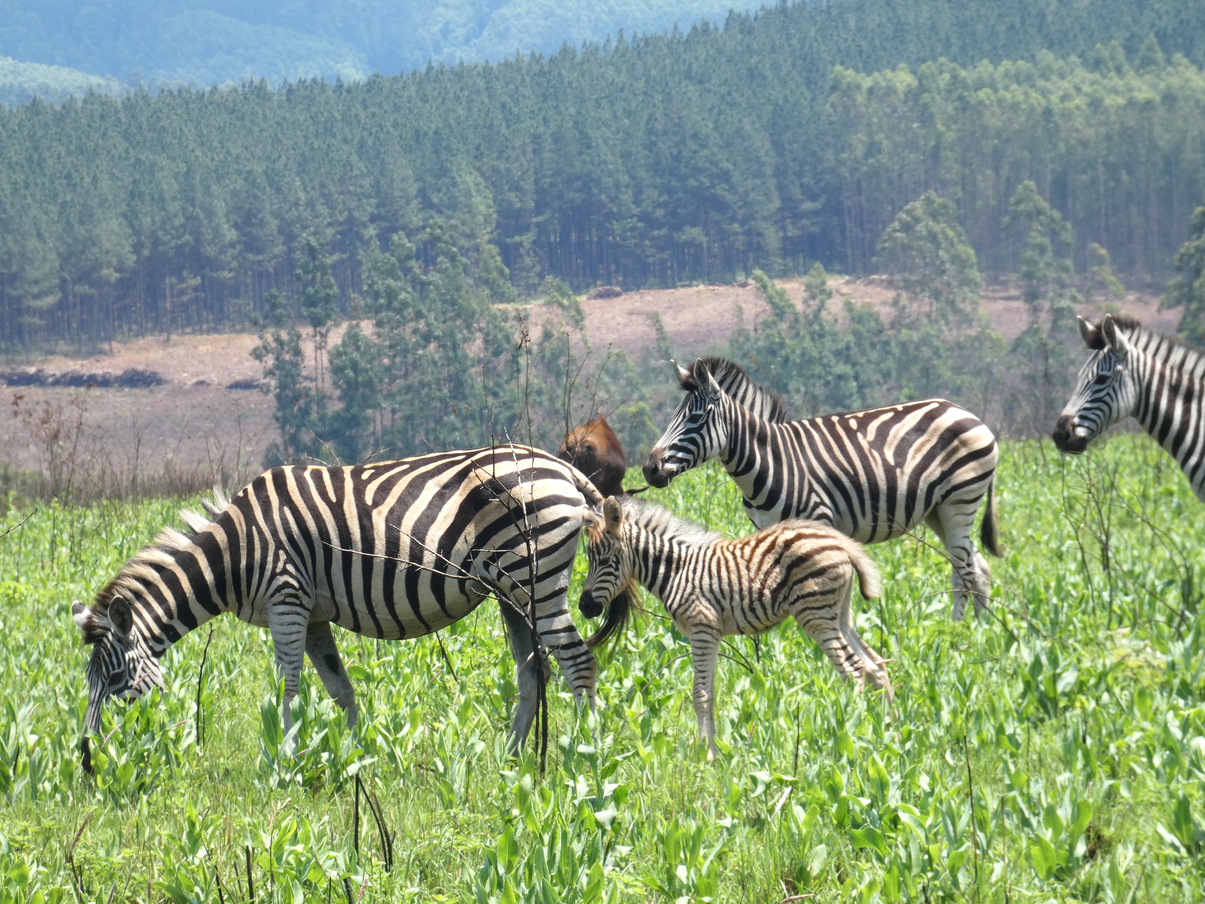
Mlilwane National Park, on the other hand, allows you to walk or cycle in the park, in large part because they have tons of animals (zebra, wildebeest, warthogs, antelopes, crocs, hippos, baboons etc) but no predators. Though a few blogs do mention a super elusive leopard, but I’m pretty sure that’s just guides preying on gullible influencers. I hoped.
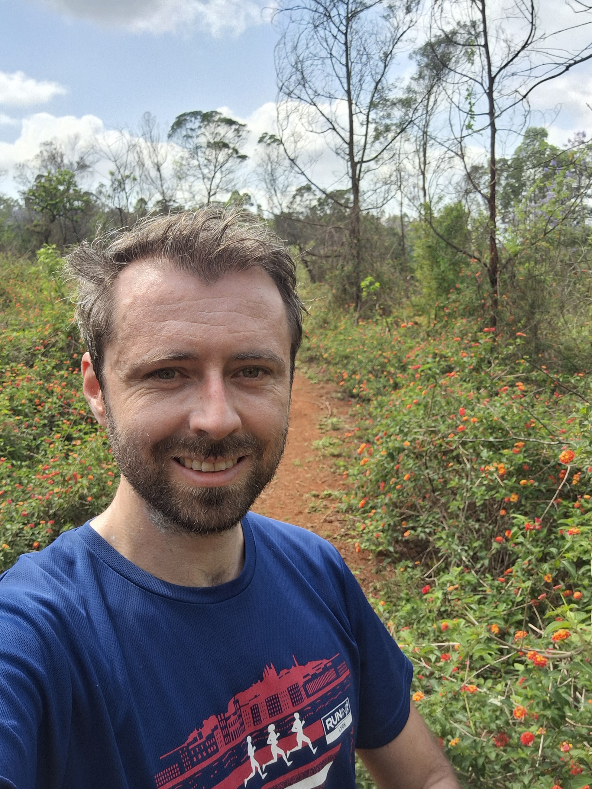
20 minutes south of the capital Mbabane, the park is easy peasy to access. I was there at the crack of dawn (figuratively speaking – to be there literally at the crack of dawn would have meant missing buffet breakfast!) as, generally speaking, animals are more active in the morning and evening. We were also in the middle of a heatwave (it’d be 43°C at Hlane National Park two days later!) which meant somewhat different temperatures to France in November.
When I got there, I was pretty keen to get going quickly, so I signed the registry book (I’m guessing they nominally come looking for you if you don’t turn up by night time), took some photos of the maps and got told which way to go by the receptionist: “Follow the Hippo Trail signs down that path, it’s easy”. Confident, off I went.
As I would find out later, within about 1.5 seconds, I had already gone the wrong way.
This may have been why, with the benefit of hindsight, I don’t think they expect people to head off without a guide!
But, for now, I was blissfully happy and unaware. I went along a few sinuous trails, stopping every now and again genuinely amazed that I was able to run amongst the wild zebra, antelopes and other wildebeest etc.
I did, however, have a nagging feeling that I probably should be seeing some more Hippo Trail signs. Especially as the few signs I was seeing were for a trail not on my map. Ah well, probably just a little further.
After I exchanged surprised looks with a family of warthogs who popped out of the bushes just in front of me and who I got to “run after” (they peak at 55km/hour so I let them win), I was starting to think that 1.5km was a long way for NO signs.
I guessed that I could just carry on and it would eventually circle around. I’m pretty good with spatial direction and always knew more or less in which direction the camp was but, after a while, it was behind two sets of forested areas, one river and three valleys and it was starting to feel a bit like a gamble if I were wrong. And there are only so many turns I can picture in my mind before I risk forgetting a critical one, especially under the thumping African sun. And there was also no phone signal.
So, a little frustrated, I turned around.
By the time I got back to camp gate, I looked to my left and, yup, less than 2 metres from the gate, I should indeed have turned right down a tiny trail instead of going down the path.
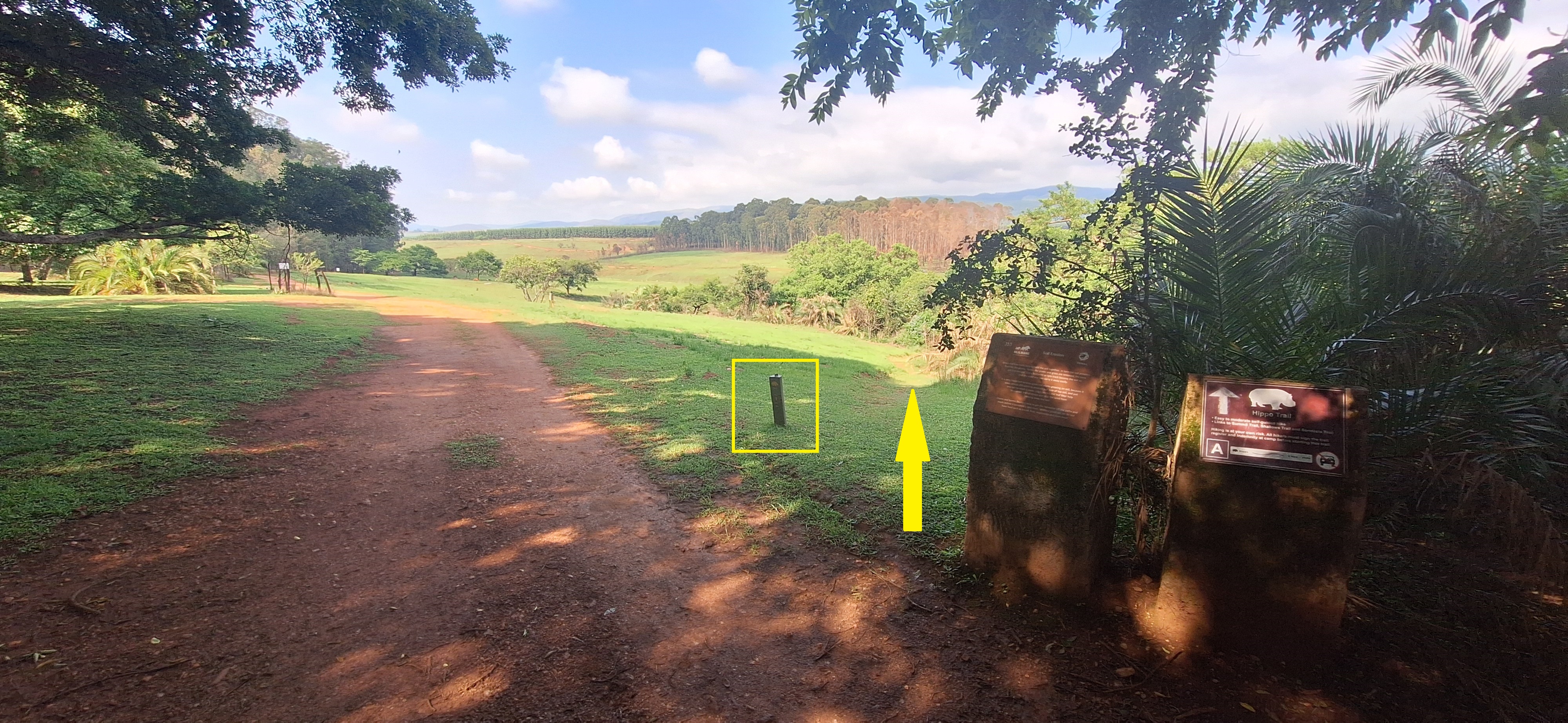
In my defence, it was not SUPER obvious!
I refilled my water at the car.
Take 2!
Now heading at a full 90° angle from where I had last been going (…), I was off. And this must have been one of the most fun runs I’ve ever done: it was a really unique – and privileged – opportunity to get to run amongst wild (OK, fine, they’re in a National Park, but they’re still pretty wild) animals within a beautiful landscape in total isolation. Once in a lifetime material.
Actually, it really was very quiet. Is there NO one else doing this trail? As I would find out an hour later: nope, I didn’t cross a single person that entire morning! When I drove around later, the couple of groups I did cross had a guide which made me wonder whether they don’t ACTUALLY expect people to disappear off into the forest alone, unguided and untrained.
Well, I did. And it was incredible. It was just a shame I had no one to share it with.
The trail was (genuinely!) reasonably easy to follow, this time around: every kilometre or so and at most junctions (most…), a hippo trail sign popped up, so I knew I was on the right track.
You are also – both reassuringly and frustratingly – never really able to get TOO close up to the animals, maybe a few meters at most. While they’re very used to humans in cars being harmless by now, they’re actually a little freaked out by the strange humanoid things walking/running towards them so go clear of you pretty promptly, which I guess is fair!
The only one that probably wouldn’t do that is the crocodile, and we did get very clear instructions to stay clear of the water. Which, well, wasn’t always easy when the path went alongside a river/stream, but YOLO eh! (on the flip side, you only live once too: let’s live long!) Joking aside, you’re a reasonable enough distance from the lake where they were, so you’d have to go looking for trouble to get into trouble.
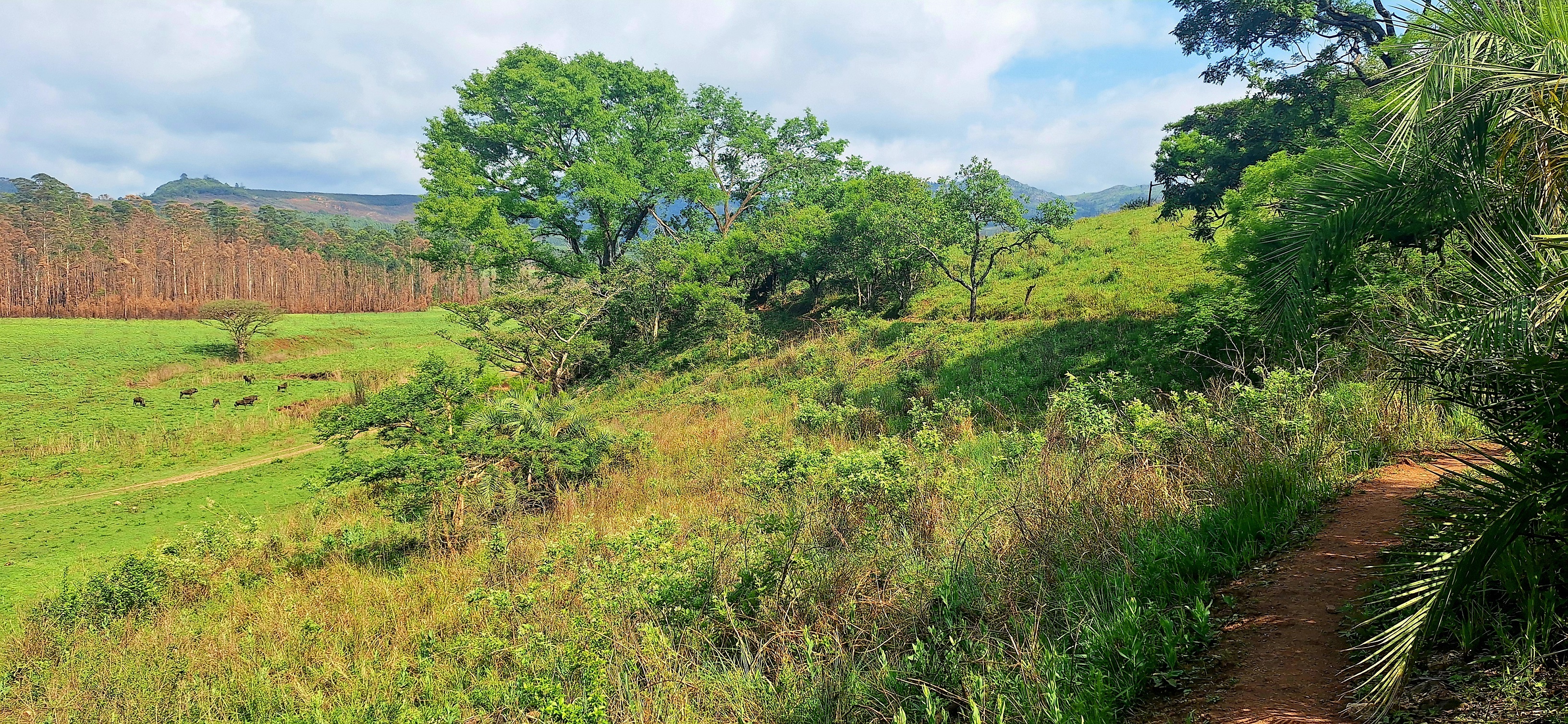
After the first few kilometres in the grassland seeing the antelopes, warthogs, wildebeest, zebra and dozens of types of birds, the trail heads into thick forest for a few kilometres.
Shade, at last!
Though I suppose animals might like shade too …
After a few minutes, I saw a lot of shuffling to my right and heard the biggest bark ever. The leopard!! Has my time come?! Wait, no, leopards are cats, they don’t bark! But this was quite a startling sound.
A few corners later and I saw the source of the ruckus: a family of really quite angry looking baboons.
Now, I’m sure they are lovely individuals if you get to know them, but I didn’t want to get to know them. They didn’t seem too fussed about me either so, after a stand-off, they went into the foliage and I walked (did not run …) by, saying very loudly “I AM NOW WALKING PAST YOU MISTER BABOON” or something to that effect. Can’t remember what it was, but it made noise and that was the point!
I was soon faced with my next challenge: a path that split in two. By now an elite bushman, I looked at the tyre marks which seemed to indicate that the path most trodden was to the right. This, therefore, must be the route.
This was not the right route. Bushman I am not. I retreated back to the actual path. Left it was.
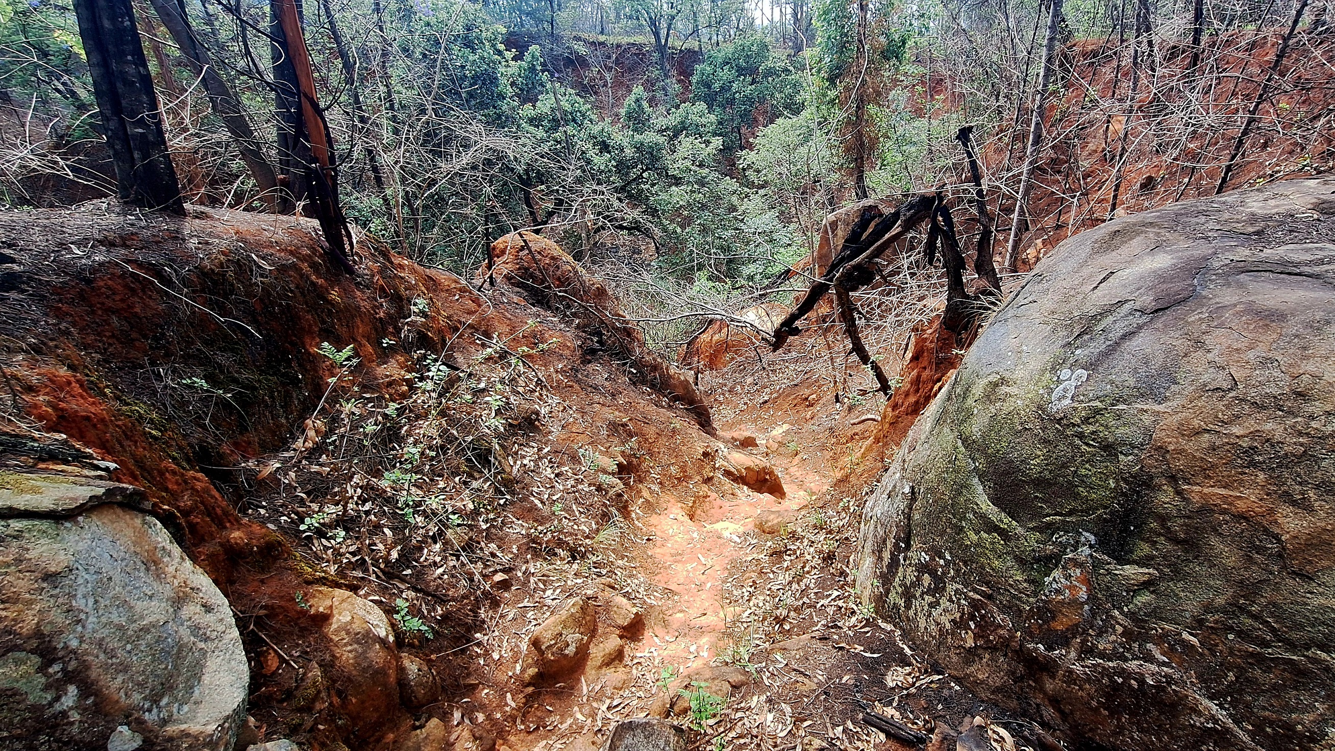
I had initially thought of running up the summit route but, well, “summit” = serious climb and it was already getting pretty toasty by now, so I headed back towards camp, taking my time as I ran through really pretty forested areas, canyons, along waterways (few crocs. No hippos mind you: surely the trail name meant they had hippos?!) and up and down some sharp, boulder-strewn inclines.
Eventually, after one last climb past some beautiful jacaranda trees in bloom (google them: wow!), the campsite came into sight and, probably as smelly and similar-looking as some of the wildebeest I ran by, I was back where I started (twice).
- Would I recommend this? Definitely!
- Is this for everyone? Probably not. You need to be reasonably confident about running into the “wild” where there’s no phone signal and, though the loop itself was only 6km (11km with my ‘detour’!), it’s still 6km up/down trails in the African heat so you need to be OK with that.
- Would I do it again? Absolutely!
Scenery

Sunshine

Difficulty

—
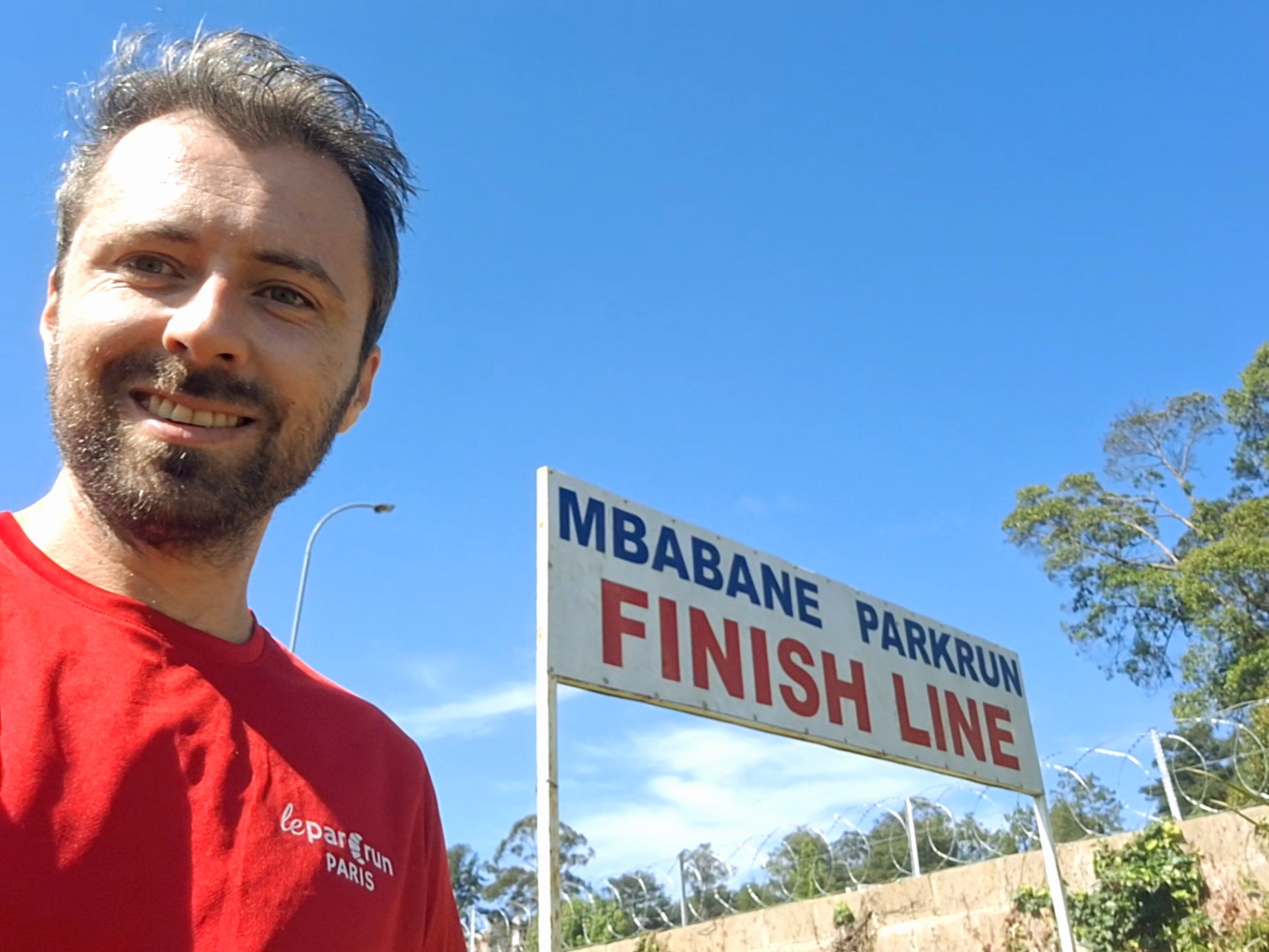
Part 2: Mbabane Parkrun – 2 November 2024
So being honest, when I was looking into how to spend the weekend before a week of work in Johannesburg (which is, as a general point, not a safe place to just chill), I had already read online that they had parkruns in eSwatini and, while it certainly wasn’t the reason I came, it definitely went into the “pro” column.
What I didn’t realise about Mbabane (the capital) was that it was deliberately positioned up a mountain (1300m which, while not SUPER high, is still the height of Ben Nevis) to be malaria-free which meant that, well, being on the flank of a mountain, was very much not flat.
- I also didn’t realise that the course would have a 60m climb over 1km.
- I also didn’t realise that the course would be 95% on grass.
- I also didn’t realise that the Real Feel temperature at 8am would be around 35°C. (though that was an unfortunate fluke: 3 days later, it would be 17°C!)
Anyway, I think I’ve got enough excuses by now? Short version: it was hot and difficult!
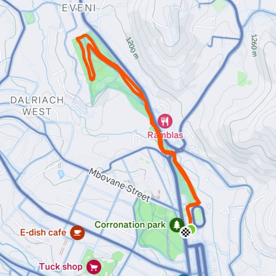
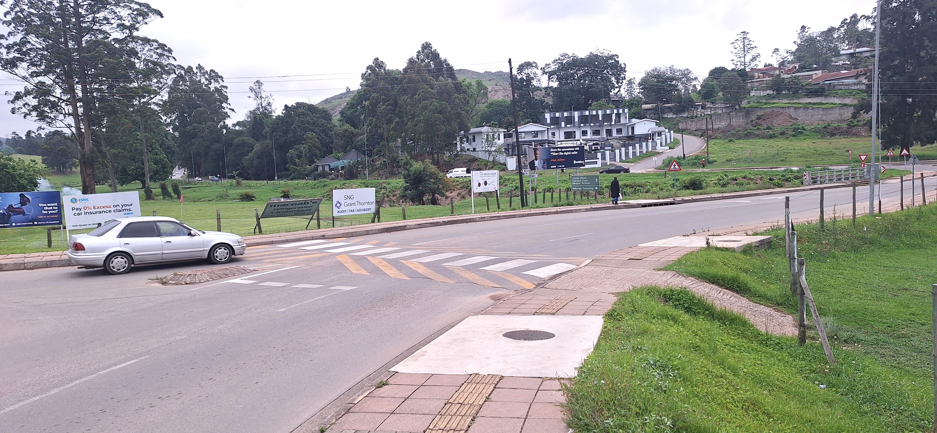
But, obsessions are obsessions, so I headed down bright and early to the Arthur Millins Pub next to the Mbabane Golf Club which is where the parkrun starts from.
The group was almost entirely locals – a friendly bunch overall, and the usual varied demographics of parkruns: old, young, fast, slow, slim, not-so-slim etc
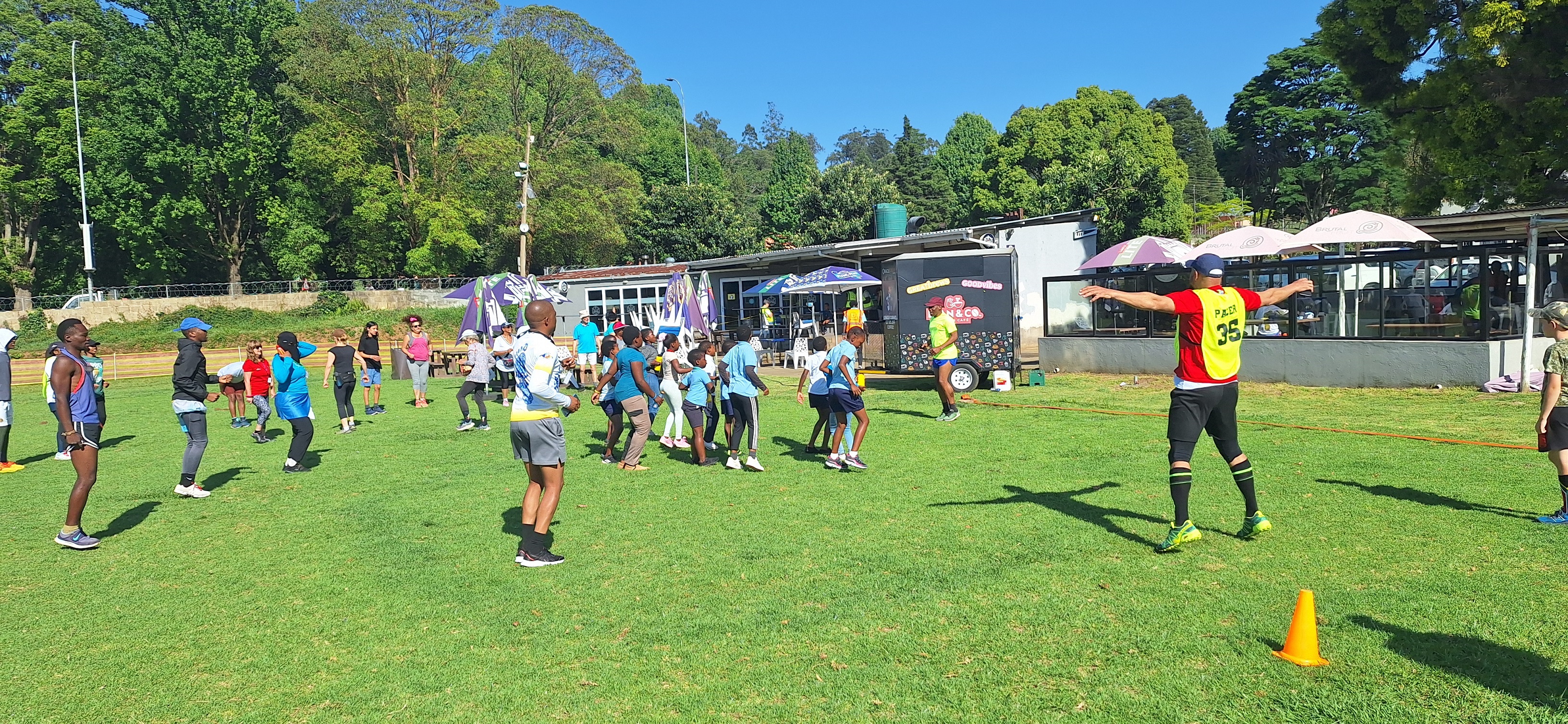
After some energetic jumping jacks to warm up (as if we weren’t already sweltering…) which suggested an element of formality, the start was given in the most informal, casual, way I’ve ever seen. Despite having an actual start line (I’ve never seen that before, nice idea), people were still stretching or standing around a few metres from the line as the director casually went “OK-well-thank-you-for-the-stretches-well-I-think-we-are-ready-threetwoone-off-you-go” with no inflection or pauses.
So: we were off!
A few under 10s shot off ahead but I thankfully caught the little bastards up quickly. They were, however, I think, the last runners I caught!
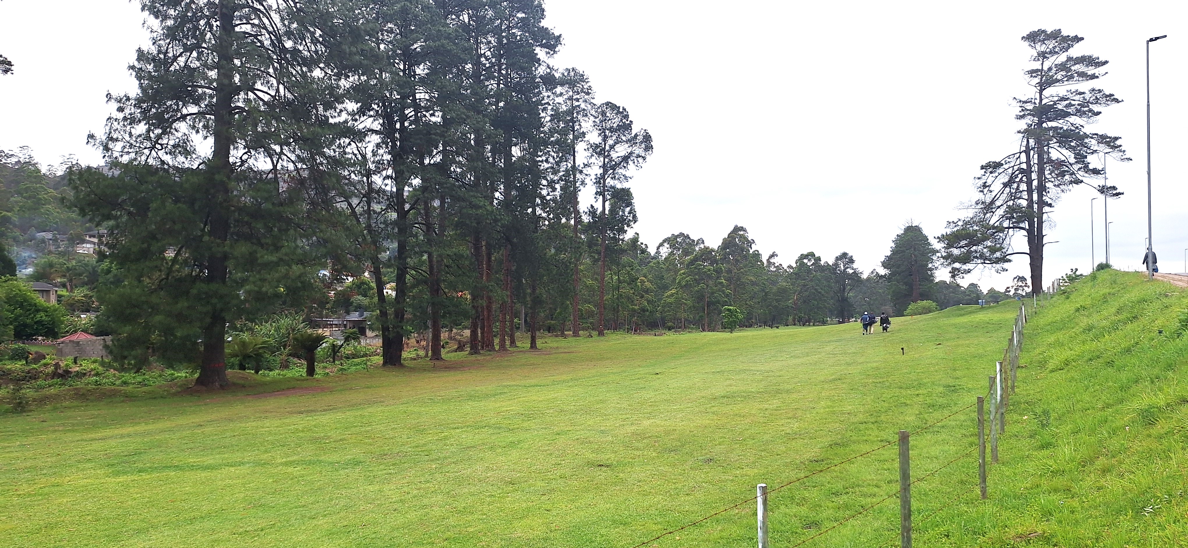
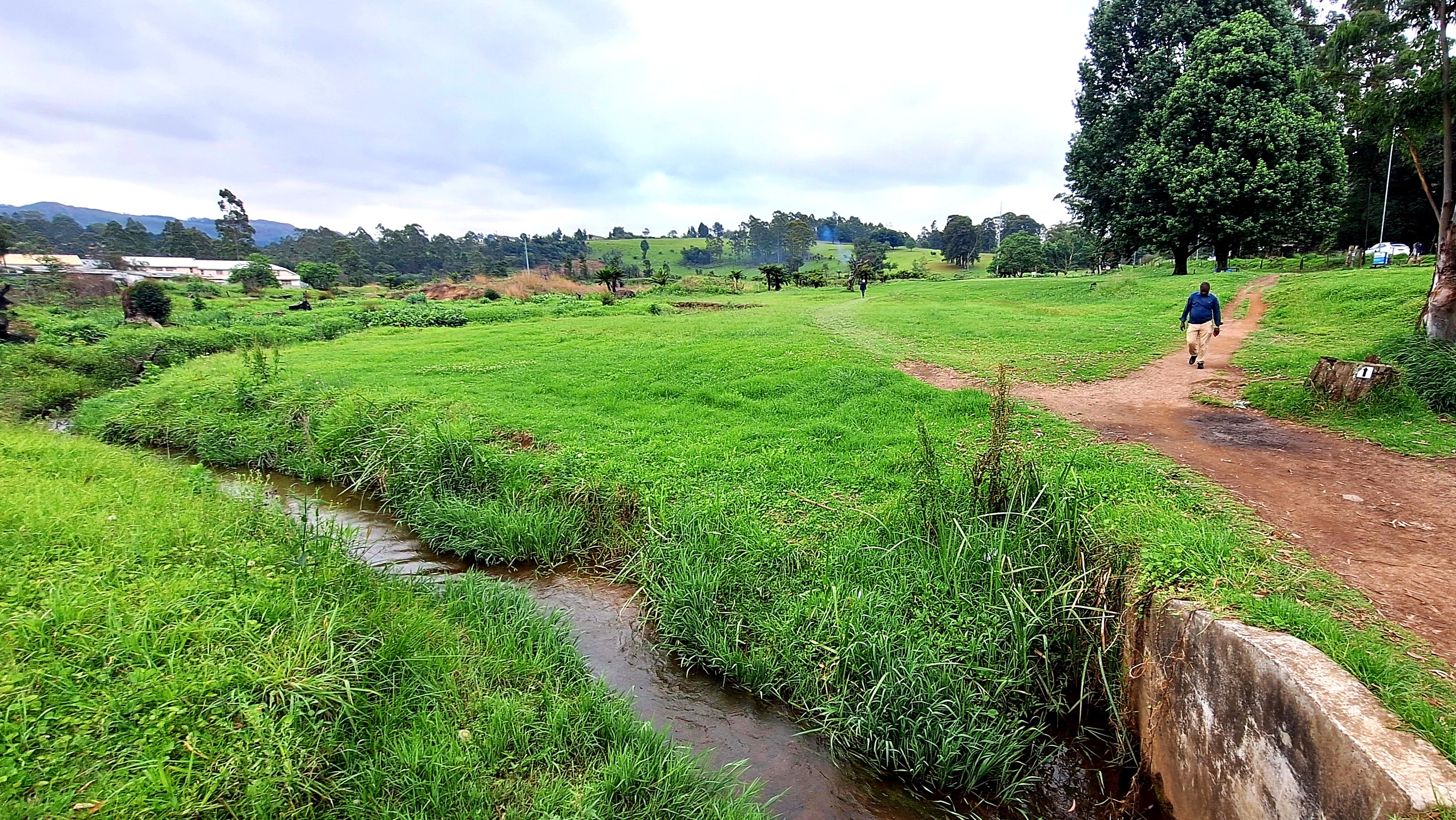
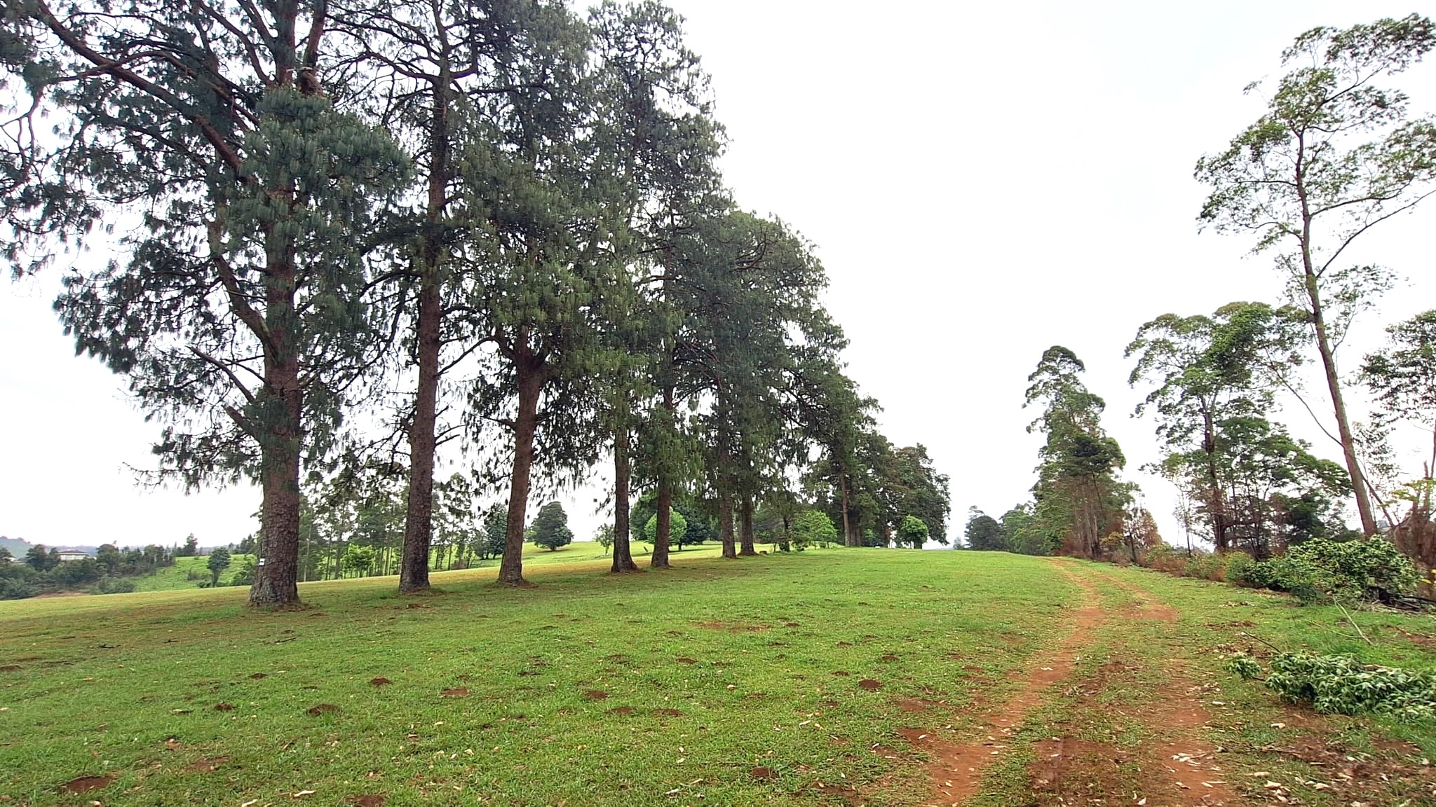
The first kilometre is flat and despite my prior whinging, pretty easy: after a few hundred meters navigating the alleys between sports pitches/car parks, you hit a shaded flat part of the golf course and carry on straight until you pop down to the stream, head into a (very dark!) tunnel under a main road and pop out the other side into the “main” section of the Golf course.
This was a very pretty place for a casual stroll or game of golf. But for a heart-raising run? Meh!
The second kilometre is evil: non-stop climb in the sunshine. In African heat. On grass. Kill me. Actually, don’t, as this could probably literally have killed me.
About two thirds of the way up, I walked for a minute to get my heart rate down: this was only parkrun, no one should actually care!
At the top of this hill, the course finally flattens out around the 3km mark and you do a sort of back and forward zig zag around one of the golf holes and a forested area before, admittedly, a much more pleasant kilometre: what goes up must come down, and the 4th kilometre was MUCH easier!
I ran like a gazelle down the hill, not-so-secretly very much enjoying watching the runners still going up the hill struggling while I could just let gravity do its magic and make me speed up.
It was little bit guesswork as to where the course actually was on the way down as the pack was very drawn out (I’d finish 3 minutes behind the person in front of me, 2 minutes before the person behind me), though I think I more or less guessed it right, apart from a few trees here and there.
We retraced our steps after a while, eventually going back under the tunnel and back towards the start. I was very much overheating by then so took a couple of short breaks in that last kilometre before hobbling over the line in around 25 minutes which, to be frank, was just fine for me.
This was, undeniably, a super tough course for the unprepared, more akin to cross-country on a nice summer day than parkrun on a yucky English winter day.
Most incredibly, the course record is 14’56 which is probably equivalent to sub-14 on flat: a local was telling me this guide was in the army which is believable, but he really should be in the national running team with that standard!
This said, based on the parkrunners’ average time mind you (15th took 30 minutes), local enemies should be able to sleep soundly for a few more years hopefully!
Time: 25’45 (11th/67)
Difficulty

Scenery

Sunshine
Speed

